Go back in time by pedaling a bike a few miles up the Little Miami Bikeway. There are still historic nooks and crannies that await anyone who wants to explore this historic and scenic area. In some spots you can literally feel at times as though you’ve been transported into the 19th or early 20th centuries. You can see and appreciate wide open spaces, farms, and small hamlets when you use the Little Miami Scenic Trail to explore the picturesque river valley north of Morrow and through the storied Fort Ancient region.
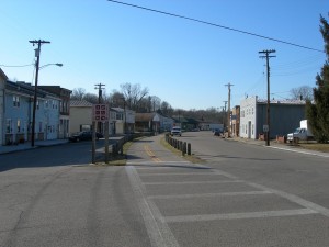
Residential and commercial development has mostly erased the farming and small community heritage of such crossroads as Kings Mills, 20 Mile Stand, and Maineville, transforming them into commuter suburbs of Cincinnati. The suburban developments that have expanded northeastward along Route 22 from the suburban Landen area since the mid-1990s now stop just short of the village of Morrow. To see what the countryside was once like, you only need to go just a bit farther.
The Little Miami Scenic Trail itself owes much of its existence to a prior life as the Little Miami Railroad, which operated from the 1840s, through several corporate mergers as an asset of Penn Central, until its formal demise as an operating railroad in December, 1981. In the mid 1980s the unused railroad grade was acquired by the State of Ohio and several municipalities along the line, and was eventually developed as a 66 foot wide linear park with a paved trail through Hamilton, Clermont, Warren, Greene, and Clarke counties.
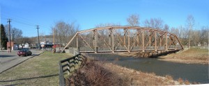
In the mid-1990s several unpaved gaps along this route were closed and extensions were built through Greene and Clarke counties. Today the Little Miami Scenic Trail is arguably one of the longest paved recreational trails in the world, at 72 miles, from Milford to Springfield. Warren County alone claims about 33 miles of the trail.
Your “virtual tour” of the Little Miami valley starts in the village of Morrow at the intersection of US Route 22 and State Highway 123. Unlike many other parts of this trail, the 15 mile round trip that is suggested in this article has the fewest road crossings per mile of almost any other portion of the trail and is rarely close to neighborhoods or houses.

Morrow is an old railroad town first planned in 1844. The old downtown business district of Morrow is being rapidly improved and redeveloped, and there are several places to eat, buy ice cream, or rent bikes. Bring your bicycle or rent a bike at one of several rental shops in town. (Note that the avid runner, walker or hiker may choose to use “foot leather” to explore this corridor, but most of us with limited time and lung power will prefer to use pedals.)
The bridge over Todd’s Fork, a major local waterway, is a scenic landmark. During spring melts, the water has crested to the level of the bridge deck at least as recently as 1998. Today Todd’s Fork is a charming rocky creek that serves as the archetypal small-town fishing hole.

Proceeding north, (carefully) cross Ohio Route 123 and pass a ball field and recreational park to your left. Then proceed through a long stretch with steep forested hills to your right and the river close by to your left. This part of the trail, from Route 123 to the crossing at Mason-Morrow-Millgrove Road, is about three miles long and is one of the most secluded stretches along the entire trail.
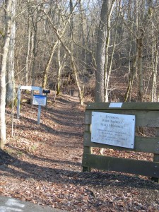
Mason and Morrow are well known cities, but what exactly is a “Millgrove”? Directly across the river on the western side stands Morgan’s Riverside camping and canoe center. In the early 19th century an even smaller settlement called Millgrove was located approximately where Morgan’s now stands. So ends one mystery.
Incidentally, the houses next to the short section of the trail from Mason-Morrow-Millgrove Road to Senior Road are part of a small village called Senior, which was settled in 1844 under the name of Hammel.
Continuing north on the trail, proceed about two miles. You will see a wood sign to your right indicating the trail up the “mountain” to the scenic Fort Ancient overlook, which is a great side trip in its own right. Fort Ancient is a walled village built by American Indians 2000 years ago as a worship center and burial place; the word “Fort” is a misnomer used by early explorers who believed that it was a strategic fortress.
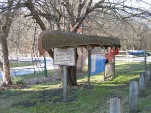
Shortly thereafter you will encounter the next road crossing, Ohio Route 350. Morgan’s main canoe center is a landmark here to your left.
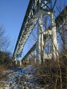
A little over a mile north from here the trail passes under the twin spans of the Interstate 71 Bridge, also called the “Jeremiah Morrow Bridge”. While this isn’t “historic”, this is nonetheless an impressive sight and is the tallest bridge in Ohio at 239 feet.
After another mile you will encounter the next road crossing, Wilmington Road. A small park with a canoe launch will be to your left here. Located at this crossroad was once a village called Mathers Mills, which is the name of the canoe launch.

Proceeding north, the trail runs parallel with Corwin Road, a local thoroughfare, and you are now in sight of houses and small farms.
The next point of local color, 1.3 miles north, is the site of the Oregonia Hillclimb, an event that draws motorcyclists from all over the country. The Hillclimb is staged in October of every year on the same weekend as the Waynesville Sauerkraut Festival.

Your final stop, another ¾ mile up the trail, is the small village of Oregonia. Oregonia was settled around 1802 as the village of Freeport. Another town in eastern Ohio with the same name dictated a name change to “Oregon” around 1845. Again there was a “name clash” with another same-named Ohio city, and finally the present name of Oregonia was adopted in 1882.
Oregonia sports a carry-out, an American Indian crafts story, and a first class restaurant, the Little River Inn. Reluctantly, the trip ends here because that’s all the time we have.
This stretch of the bike path is only a 15 mile round trip, which is a comfortable afternoon ride even for most beginning bicyclists. This outing could be turned into more substantial ride for seasoned cyclists by extending your journey through Waynesville and beyond. The long distance pedaler could make an overnight trip of it with a layover in Yellow Springs, Cedarville, or Springfield. Or, linger at one of the many attractions along the way and make a day of it. Have your own personal adventure, and enjoy this peaceful and historic slice of Warren County!

Don Wallace is a local writer and IT consultant. His email is thedonaldwallace@gmail.com.
Hammel and Senior were two separate settlements, about a half mile apart. Hammel was located across the river from Morgan’s Campground on Strout Road. Senior was about half a mile north of there where Senior Road crosses the trail. In the fields beyond that you can see the brick structures that used to be part of the Senior powder mill.